
Reviewed · HIKING & TREKKING
Almaty: Advanced Hiking – Four Peaks Hike
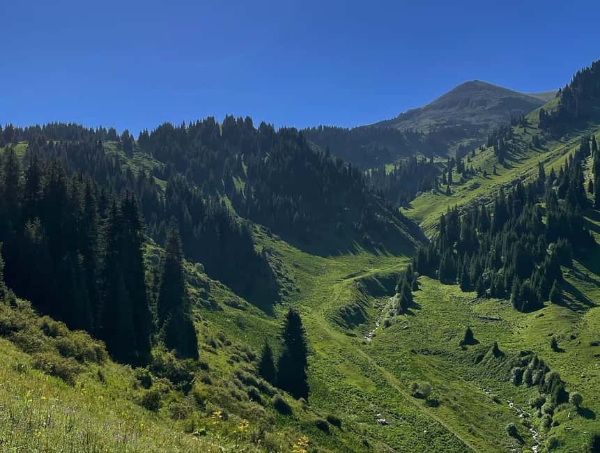
The mountains make you earn every view. This demanding private hike links four peaks near Almaty, with mountain swings, ridge walking, and huge views across the Ile Alatau. I like the four-summit challenge and the comfort of a private guide who can control the pace. I also like the practical finish: after a long day, you descend by cable car from upper Shymbulak instead of walking every step back down.
The catch is simple: this is a serious mountain day, not a casual sightseeing walk. Up to 2,000 meters of climbing over roughly 8 to 10 hours will test your legs, and snow or ice can make the route tougher. Guides Victor, Valihan, and Temirlan have all received praise for keeping the experience organized and safe, but you still need solid fitness and confidence on rough mountain ground.
In This Review
- Four things to know before you book
- What the Four Peaks route really involves
- Starting in Kim Asar Valley
- The mountain swings and the first big views
- Furmanov Peak at 3,050 meters
- Ridge walking toward Panorama Peak
- Bashuta Peak and the final push
- Chimbulachka Peak at 3,450 meters
- Finishing at Shymbulak by cable car
- How difficult is the climb?
- Safety, guides, and private group value
- What to pack for this Almaty mountain day
- Seasonal conditions and route changes
- Is $210 a fair price?
- Should you book the Four Peaks Hike?
- FAQ
- How long does the Four Peaks Hike take?
- How far is the hike?
- What is the highest point?
- Is the hike suitable for beginners?
- Are trekking poles and crampons provided?
- Is hotel pickup included?
Four things to know before you book
- Four summits in one day: Furmanov, Panorama, Bashuta, and Chimbulachka make this one of the toughest day hikes near Almaty.
- A major climb: You gain up to 2,000 meters, starting around 1,845 meters and reaching 3,450 meters.
- Private guiding matters: Your guide can adjust the pace, monitor conditions, and provide safety support throughout the route.
- A smart finish: The hike ends near the upper Shymbulak cable car station, followed by a scenic ride down.
- Winter changes the plan: Snow, ice, avalanche risk, and cable car schedules can alter the route and timing.
- Hotel transfers are included: Pickup and drop-off in Almaty remove much of the day’s transport hassle.
What the Four Peaks route really involves
The Four Peaks Hike is built for experienced hikers who want a full mountain challenge close to Almaty. It combines distance, steep ascent, high altitude, and a ridge traverse rather than one simple climb to a single viewpoint.
The route is described as approximately 15 kilometers in the general overview, while the detailed route information gives 11.5 kilometers. That difference is worth clarifying with the guide before you set out, since route adjustments, seasonal conditions, and the exact starting point can affect the final distance.
The altitude figures are more consistent. You begin around 1,845 meters, reach a high point of 3,450 meters at Chimbulachka Peak, and finish near 3,200 meters at the upper Shymbulak station. The total ascent can reach 2,000 meters, which tells you more about the effort than the distance alone.
I would treat the advertised 10-hour duration as a full-day commitment. The schedule includes several hiking sections, long stretches on the ridge, transfers, and the cable car descent. You need to be ready for an early start, changing weather, and a day when the mountain sets the pace.
Other things Almaty City readers book alongside this:
- Almaty: Charyn Canyon, Kolsay, and Kaindy Lakes Day Trip
★ 4.7 · 1,522 reviews - Almaty: Kolsai-Kaindy Lakes and Charyn Canyons Day Trip
★ 4.7 · 505 reviews - From Almaty: Kolsay, Kaindy Lakes and Charyn Canyon Day Trip
★ 4.6 · 452 reviews
Starting in Kim Asar Valley
Your day begins with private pickup in Almaty. The guide and driver collect you at your hotel or another agreed location, then take you toward the Kim Asar Valley, where the hike begins at roughly 1,845 meters.
Private transport is useful here because you do not need to arrange a separate taxi or work out mountain access on your own. Pickup details are sent the day before, and communication takes place through WhatsApp or Telegram, so provide a working mobile number when you book.
The first part of the hike is a steady uphill push. The schedule breaks the opening climb into one-hour sections, which gives the guide natural points to check your pace and energy. Do not mistake the gentle start for an easy day. The route has a lot of climbing still ahead.
The Kim Asar Valley provides the transition from city to high mountain. As you gain height, the route moves away from ordinary roads and into rougher terrain. Trekking poles are supplied for each person, a useful touch on steep ground and later on loose or slippery sections.
The mountain swings and the first big views
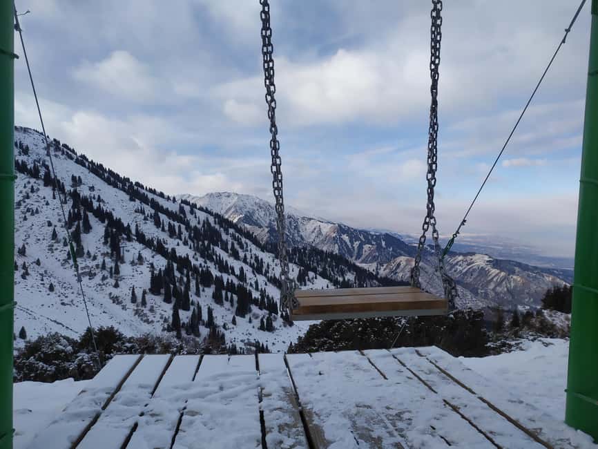
The famous mountain swings are one of the route’s early highlights. They give you a memorable pause above the valley and a chance to take in the changing scale of the mountains around Almaty.
This is also where the hike begins to feel like more than a long uphill walk. The swings are a popular visual marker, but the main value is their position on the ascent. You are high enough to see broad mountain views, yet still have several demanding hours ahead.
Use this section to settle into your rhythm. Keep your steps short, drink regularly, and avoid spending too much energy on the first viewpoints. The route rewards steady effort better than a fast start.
The guide’s role becomes important on a private trip. You are not tied to a large group’s speed, and the guide can make sensible pauses based on your condition. The team also carries a GPS navigator because mobile signal is not available on every route.
Furmanov Peak at 3,050 meters
Furmanov Peak is the first named summit, reaching about 3,050 meters. The route schedule allows roughly 1.5 hours for the section around the peak, after the earlier approach.
Furmanov is a useful milestone. You have completed a large part of the initial climb, and the views begin to open in a more serious way. From here, the day changes character. Instead of only gaining height, you begin following a ridge toward the next summits.
At this altitude, weather can feel less predictable, and the air may be noticeably colder than in Almaty. Bring warm layers even if the forecast in the city looks mild. The supplied advice to pack extra clothing is not filler. On an exposed ridge, wind and cloud can change your comfort quickly.
Furmanov is not the highest point, so do not use it as your test of whether the day will be easy. Panorama, Bashuta, and Chimbulachka still lie ahead, with more climbing and rough mountain terrain between them.
Other walks in the Trans-Ili Alatau:
- Big Almaty Lake Tour with Optional Hike
★ 4.3 · 109 reviews - Almaty: Hiking to the High Mountain Pasture Kok Zhailau
★ 4.7 · 5 reviews - Skyline Hike in Almaty: Bukreev Peak
★ 5.0 · 2 reviews - Big Almaty Lake tour private or group by car or hiking
★ 4.5 · 46 reviews
Ridge walking toward Panorama Peak
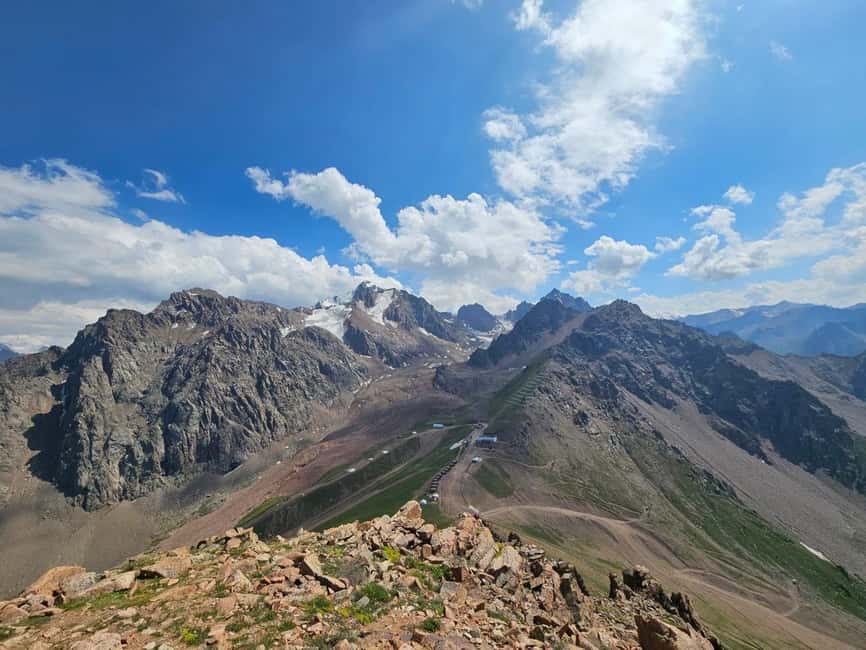
After Furmanov, the route continues along a scenic ridge. The schedule divides this stretch into several one-hour hiking periods, followed by a longer section of about 2.5 hours. That long middle section is likely where the route demands its best combination of stamina, balance, and concentration.
Panorama Peak rises to about 3,200 meters. The name says what makes it special: broad views over Almaty and the higher Tien Shan mountains. This is the point where the route’s reward becomes especially clear. You are no longer looking at the mountains from the edge of the city. You are moving through them, with the ridge itself becoming the viewpoint.
Ridge walking can feel more exposed than forest climbing, even when no technical climbing is involved. You need confidence on uneven ground and the ability to keep moving when the path is less obvious. This is one reason a private guide adds real value. The guide handles route control while you focus on footing and energy.
The route is not presented as a technical mountaineering ascent, but advanced ability is still required. You should be comfortable with long uphill days and mountain terrain before booking it.
Bashuta Peak and the final push
Bashuta Peak reaches around 3,400 meters, making it the second-highest summit on the route. By this point, your legs have already handled a large climb, a ridge traverse, and several hours of walking.
Bashuta is where pacing becomes crucial. You might feel strong early in the day, then find that altitude and accumulated climbing slow you down. A private guide can keep the day manageable by adjusting the speed rather than treating the schedule as a race.
Kazakh chocolate is provided along the way. It is a small detail, but sweet food can be welcome during a long effort, and it adds a local touch without pretending that snacks replace lunch. Lunch is not included, so ask the guide in advance about the best way to handle food for your particular departure.
You should carry enough water and food for a demanding day, although the supplied information does not specify water sources or a meal plan. A packed lunch is the sensible choice unless the provider gives you different instructions.
Chimbulachka Peak at 3,450 meters
Chimbulachka is the highest point of the route at about 3,450 meters. This is the main summit goal and the moment when the full scale of the day becomes clear.
Reaching the top requires more than enthusiasm. You need stamina for the climb and enough control left in your legs for the descent or final walk to the cable car station. The high point is also where conditions may be cold, windy, snowy, or icy depending on the season.
Winter hikers receive snow crampons that fit over winter boots. These help reduce slipping, but they do not turn a difficult route into an easy one. You still need warm clothing, sturdy hiking shoes, and comfort on snow-covered ground.
Winter also reverses the route. Instead of starting in Kim Asar Valley, you take the cable car up to around 3,200 meters, climb toward Chimbulachka, then descend on foot toward Kim Asar Valley. This version places the highest section near the beginning, so ask specifically which direction will be used for your date.
Finishing at Shymbulak by cable car
After the ridge traverse, the route finishes near the upper Shymbulak cable car station at approximately 3,200 meters. The descent by cable car is one of the best practical decisions built into the experience.
Walking down from 3,450 meters after a full day would add more strain to tired knees. The cable car gives you a comfortable ride back toward the valley and a final chance to enjoy the mountain views without concentrating on every step.
The transfer back to Almaty takes about 1.5 hours according to the schedule. With pickup, hiking, the cable car, and the return drive, the full day can reach 10 hours. Keep your evening light. This is not the tour to schedule immediately before a late dinner or another active outing.
Cable car maintenance can affect the plan during April to May and September to November. The route may need to be adjusted if the lift is unavailable, so confirm the operating situation before your hike.
How difficult is the climb?
The experience is rated advanced, and that rating should guide your decision. A moderate level of fitness is listed as necessary, but the actual route details point to something more demanding than a typical moderate walk.
You should be prepared for:
- Up to 2,000 meters of elevation gain
- Roughly 8 to 10 hours on the mountain
- About 11.5 kilometers in the detailed route description, with the wider description giving approximately 15 kilometers
- Altitude reaching 3,450 meters
- Snow and ice in winter
- A long ridge traverse
- Limited mobile signal on parts of the route
This hike is not suitable for children under 16, pregnant women, people with heart problems, people over 80, people with high blood pressure, or people with a low level of fitness. Those restrictions are sensible. The route’s main risk is not just distance, but the combination of steep ascent, altitude, weather, and fatigue.
If you regularly hike steep trails and can manage a full day at altitude, the challenge may be exactly what you want. If you mainly take short city walks or easy day hikes, choose a gentler Almaty mountain experience.
Safety, guides, and private group value
The strongest praise for this experience centers on the guides and the feeling of safety. Victor was praised for checking that the hike felt safe, while Valihan was singled out for handling the tough route in an organized way. Temirlan was described as competent, friendly, and reassuring throughout the day.
Those details matter because a demanding mountain route benefits from calm leadership. Your guide provides trekking poles, carries a GPS navigator, and offers route control when the signal disappears. On winter departures, crampons are included as well.
The private format is another major advantage. Your pace is not dictated by strangers, and the guide can respond to your condition and the weather. It also makes the $210 price easier to understand. You are paying for a full private day, hotel transfers, guiding, national park entry where applicable, safety equipment, and the cable car finish.
It is still a significant price for one day, especially since lunch, dinner, and insurance are not included. For a solo hiker or small private group that values safety and transport, the cost can be fair. If you are mainly seeking a cheap mountain view, it is more than you need.
What to pack for this Almaty mountain day
Start with proper hiking shoes. The route includes uneven terrain, and winter crampons are designed to fit over winter boots, not ordinary casual footwear.
Wear comfortable layers and bring warm and extra clothing. At 3,450 meters, conditions may differ sharply from those in Almaty. Sunscreen, a cap, and sunglasses are also important because high-altitude sun can be strong even when the air feels cold.
A practical packing list includes:
- Hiking shoes
- Warm layers and spare clothing
- Sun protection
- Sunglasses and a cap
- Food for the day, since lunch is not included
- Water
- A charged phone with WhatsApp or Telegram
- Any personal medication you require
The guide carries navigation equipment, but your phone remains useful for communication before and during the tour. Do not depend on mobile coverage in the mountains.
Seasonal conditions and route changes
The hike operates year-round with restrictions and adjustments. Winter conditions make the route more difficult because of snow and ice. The route is reversed, with a cable car ascent followed by a descent on foot toward Kim Asar Valley.
April and November can bring avalanche risk. That does not mean every departure is unsafe, but it does mean conditions deserve careful checking. The route may be changed for safety, and the guide should confirm the plan close to the date.
Cable car maintenance is possible from April to May and from September to November. Since the normal route finishes with a cable car descent, maintenance can affect the final section and the overall logistics.
The provider contacts you a few days before the hike to confirm weather and equipment recommendations. Pay attention to that message. On a high mountain route, the plan should respond to conditions rather than follow a fixed promise at all costs.
Is $210 a fair price?
At $210 per person, this is not a budget walk. The value comes from the amount of planning and support packed into one long day.
You receive private hotel transfers, an English-speaking live guide, national park entry where required, trekking poles, winter crampons when needed, GPS support, and Kazakh chocolate. The private group format also means a more personal pace and fewer compromises.
The price makes the most sense if you are visiting Almaty specifically for serious mountain access and want four named peaks in one outing. It is less attractive if you do not hike regularly, do not need private transport, or would prefer a short viewpoint excursion.
Free cancellation up to 24 hours before the start and reserve-now-pay-later terms provide useful flexibility. They do not remove the need to check weather, cable car operation, and your own fitness before committing.
Should you book the Four Peaks Hike?
Book it if you want a demanding private mountain day, can handle up to 2,000 meters of climbing, and care more about high ridges and summits than relaxed sightseeing. The four peaks, strong views, private guiding, and cable car finish create a well-shaped challenge.
Skip it if you have limited hiking experience, health concerns listed in the restrictions, or a preference for easy trails. Before paying, confirm the expected distance, route direction for the season, cable car status, food plan, and weather.
For fit hikers, this is one of the more serious and rewarding ways to see the mountains near Almaty. The high praise for Victor, Valihan, and Temirlan also gives you useful names to request when discussing your booking.
FAQ
How long does the Four Peaks Hike take?
The experience lasts about 10 hours, with the hiking portion generally taking 8 to 10 hours depending on the route and conditions.
How far is the hike?
The detailed route information gives a distance of 11.5 kilometers, while the broader route description says approximately 15 kilometers. Confirm the expected distance with the guide before departure.
What is the highest point?
Chimbulachka Peak is the highest point at approximately 3,450 meters.
Is the hike suitable for beginners?
No. It is rated advanced and requires good fitness, stamina, and confidence on mountain terrain.
Are trekking poles and crampons provided?
Trekking poles are provided for every participant. Snow crampons are provided for winter hikes and fit over winter boots.
Is hotel pickup included?
Yes. Private round-trip transfers from a location in Almaty are included, with pickup and drop-off details sent the day before the hike.
Freshly written up around Almaty City
- Three Brothers Peak and Kok Zhailyau: Path to the Clouds★ 3.9 · 4 reviews
- Shooting tour – AK 47, Mosin -Nagant , Glock and others★ 4.8 · 5 reviews
- Skyline Hike in Almaty: Bukreev Peak★ 5.0 · 2 reviews
- From Almaty: Charyn Canyon Private Day Trip★ 4.8 · 5 reviews
- Almaty 1-Day Tour: Kolsay, Kaindy & Charyn Black Canyon★ 5.0 · 3 reviews
- Big Almaty lake tour off road bike★ 5.0 · 3 reviews
- Almaty: Shymbulak, Medeu, Kok Tobe by cable cars and tickets★ 5.0 · 5 reviews
- Almaty : Must-See Private Walking tour★ 5.0 · 3 reviews
Hiking & Trekking, compared.
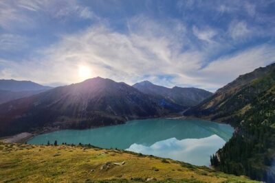
Big Almaty Lake tour private or group by car or hiking
Read our review →
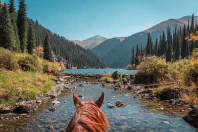
3-Day Private Horseback Riding and Hiking Tour in Kolsay
Read our review →
Shymbulak to Bogbanovisch Glacier and Oktabriskaya Hike
Read our review →
Browse the lists this tour appears in